LiDAR
LiDAR (Light Detection and Ranging) allows for the collection of elevation data of ground and above ground objects from an aircraft or UAV mounted laser sensor. This data can then be classified and used in the generation of Digital Terrain Models (DTM) and Digital Surface Models (DSM) that consist of bare earth and non-bare earth data sets. Aeroquest Mapcon has extensive experience in the classification, surface modeling and delivery of LiDAR data.
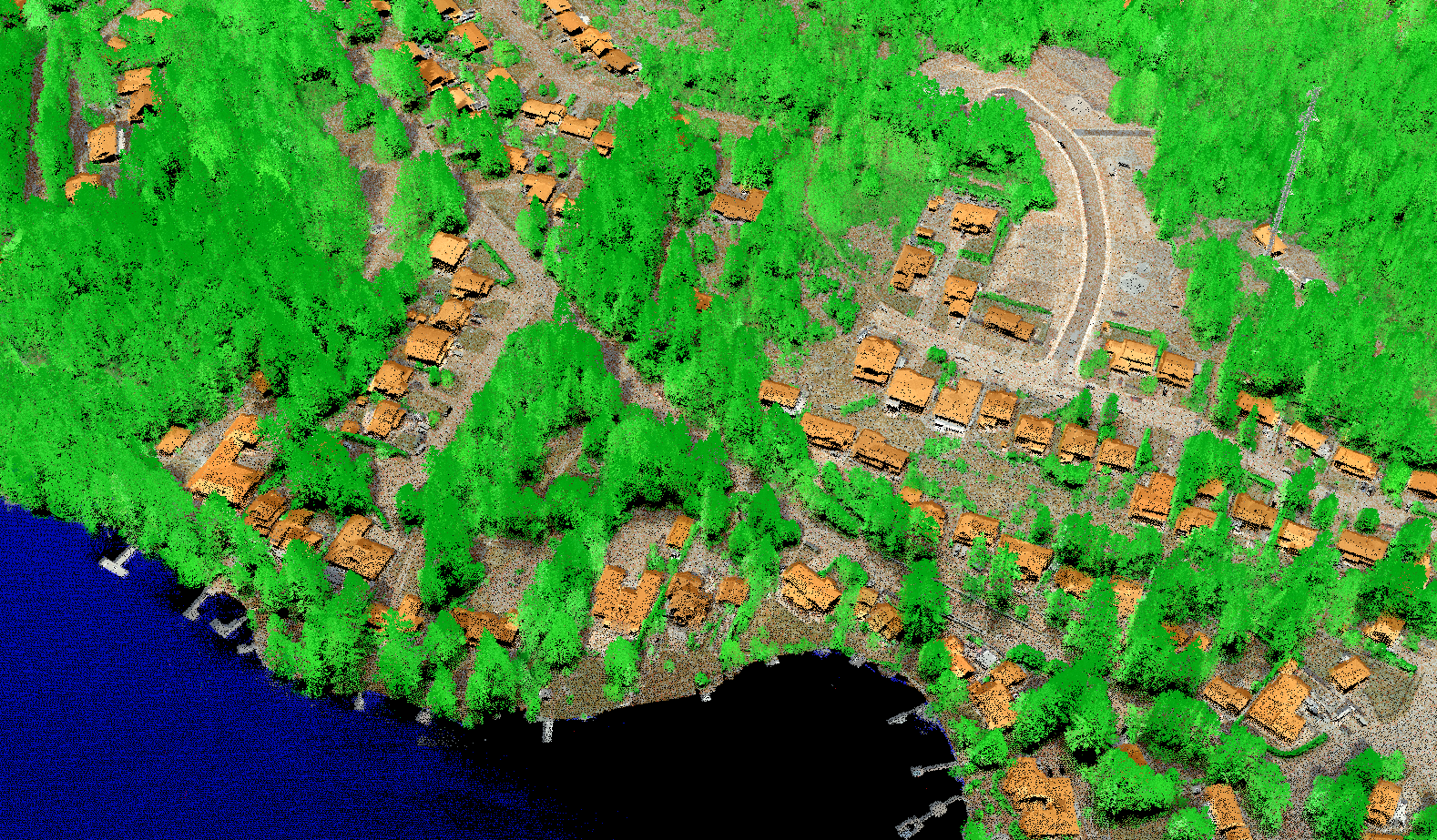
Classified Lidar
Classified LiDAR data allows our clients to work with 3-D point data that has not only positional attributes, but also classification information as to the type of surface. LiDAR can be filtered and classified into many different data types including bare earth, vegetation, buildings and powerlines. The classified data can be used for detailed analysis such as height and volume calculations, in addition to the bare earth points being used as a surface for image rectification.