

Aeroquest Mapcon has been providing geospatial data and services to industry and all levels of government across North America for more than 20 years. We are cognizant of the crucial role that such information and technology plays in daily decision making, and aim to offer innovative and industry leading solutions to clients .
From satellites, aircraft or UAV's, we provide professional airborne surveys at every level.
Airborne Survey PLATFORMS & SENSORS
With access to aircraft, satellite and UAV imaging platforms, Aeroquest Mapcon has the capabilities to meet your project needs.

Orthophotography
Orthophotography produced to your project specifications.


surface modeling
Generation of Digital Elevation Models (DEM), Digital Surface Models (DSM) and Point Clouds for accurate digital representations of bare earth and non-bare earth surfaces.

planimetry
Collecting ground features in stereo for accurate x,y,z positioning and data attribution of road edges, building footprints, utilities, land use types, impermeable surfaces, change detection, mass points, break lines, and more.
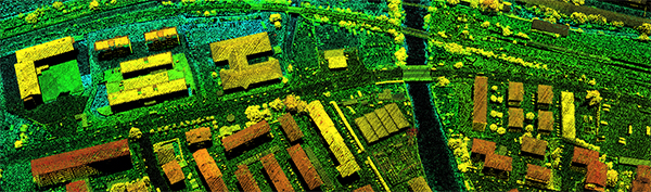
lidar
Light Detection and Ranging - Aircraft mounted sensor to capture ground topography used for data analysis, classification and surface modeling.

contours
Contour lines represent lines of constant elevation illustrating ground slopes, hills, valleys and steepness of terrain.

3-D mesh
Generation of 3-D meshes combining digital surface models with aerial imagery to provide three dimensional photo models of surface features.
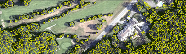
Urban Forest Canopy Modelling
Using LiDAR data, urban forest canopy models can be created showing individual tree crowns, heights and types, and can also be attributed with identifier and location ID.

Historical Mapping
Processing historic imagery using modern mapping techniques to provide spatially accurate data.